On May 18, 2016, the seventh annual meeting of China Satellite Navigation Society was opened in Changsha, Hunan. As a leader in Beidou high-precision location services and industry application, Wuhan LJDY Technology Co., Ltd. (stock code: 832170) presented its DeuSmart® Beidou series of softwares, Beidou high precision smart helmet , Beidou high-precision positioning terminals, Beidou intelligent terminal networking, high-precision positioning Beidou bracelet and other products, as well as solutions in smart pipeline network, smart grid, smart mining and smart transportation application, giving a comprehensive display of LJDY’s technical strength in Beidou high-precision applications .
LJDY’s Presentation Stand
During the meeting, Academician Liu Jingan of Chinese Academy of Engineering visited LJDY’s stand, acquainting with the Beidou serial products and commending the achievements LJDY has reached.
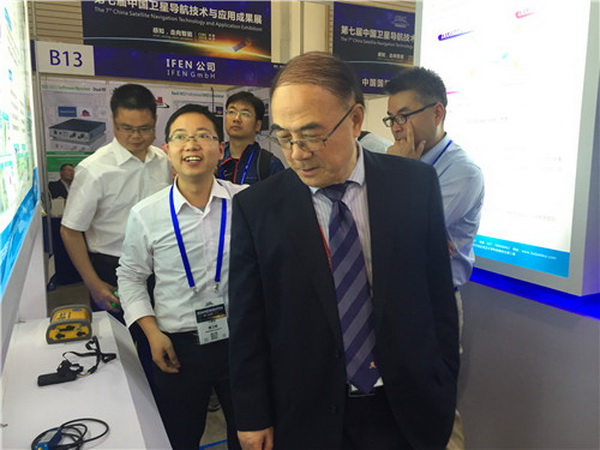
Academician Liu Jingnan Visiting LJDY’s Stand
Su Weimin, the General Manager of Hunan LJDY was invited to the meeting and made a report of The Application of Beidou in Electric Field. In this report, he introduced Beidou positioning, navigation and other functions which attracted attention from attendees and media.
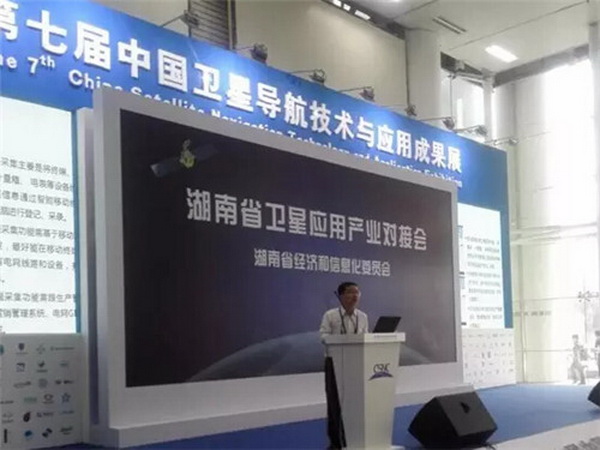
Su Weimin Giving A Report

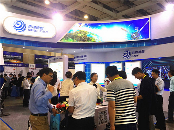
Representatives from The Meeting Learning about Beidou Products
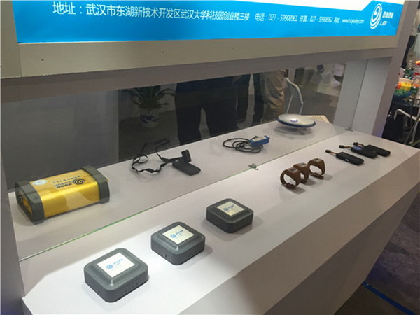
LJDY’s Stand Displaying Beidou Hardware Devices
Based on 3D GIS, LJDY aims to enhance Beidou application to serve urban construction. Through cooperating with National Engineering Research Center for Satellite Positioning System, LJDY devoted to the R&D and project practice of Beidou ground-based augmentation. LJDY also worked out the entire hardware and software product and solution plan for Beidou ground-based augmentation. The Panda serial receivers are the only receivers for Beidou ground-based augmentation system which have been running steadily for over two years and the only receivers which have passed the acceptance by National Ministry of Science and Technology and National Administration of Surveying, Mapping and GeoInformation. Its performance matches DeuPanda® Beidou/GNSS high-precision positioning software and DEUPNW® Beidou ground-based augmentation management and service software. In 2005, LJDY constructed the Xinjiang CORS project and Data Center of Xinjiang Modern Surveying and Mapping Basic System project to assist the Beidou information construction in Xinjiang.