On 1st Nov, the 2016 China Geo-Information Industry Conference was held in Changsha. As the highest level conference in geographic information industry, it was hosted by China Association for Geographic Information with a theme of “innovation, transformation, integration and development”. Over 1500 domestic and overseas geographic information enterprises attended the conference. During the conference, the latest China geo-information report was released as well as the advancement award for China geographic science and technology and engineering excellence award. A series of meetings on thematic discussion and senior seminar were held in the conference. Also, new technology, products and devices were presented in the conference.
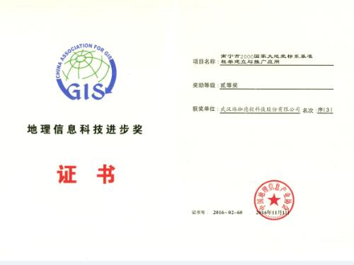
Based on the requirements in the coordinate transformation market, LJDY designed the coordinate transformation software according to the Geo-Information data in Guangxi. Data of different periods, sources and scales are able to be transformed. DEU2000® has been widely and successfully applied in the information center of Guangxi Homeland Resource Office and other 14 Homeland Resource Offices, which was widely acknowledged by all leaders in different departments.
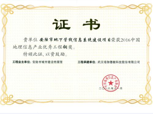
Based on general survey, LJDY built up a comprehensive information system of underground pipelines for Anlu to realize a digitalized, networked, visual and smart underground pipeline information system, which fulfills the needs for underground pipeline information sharing and serving. In future, it will serve for urban planning and management for government supervision, construction and standard management.